Bhaktapur.com
Our city, Our pride
Information
Popular Places
Four Municipalities
Bhaktapur Municipality
Changu Narayan Municipality
Suryabinayak Municipality
Madhyapur thimi Municipality
Festivals
Monuments
Culture
Hotels
Foods
Hiking Trails
Get your guide
Directory
Directories list
Directory Submit
Photos
Photo Stories of Bhaktapur
Old Photos Collection
Recent Photos
Submit your photo
Videos
Podcast Bhaktapur
Videos Gallery
Events
Promote your event
Blogs
Blog list
Nepali Blog
Welcome
Welcome
city
View of Bhaktapur from Suryabinayak in 1972 AD
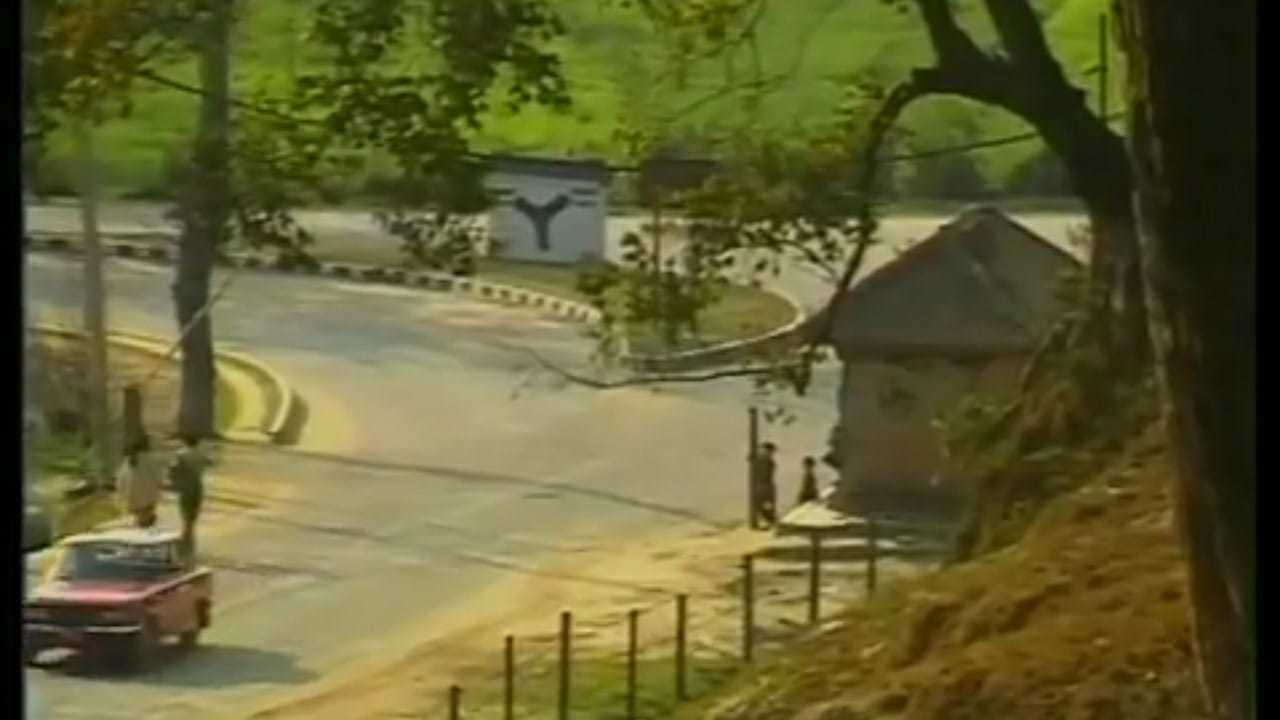
Sallaghari
Byasi to mahakali
Taken from an airplane, the top of the photo is toward the west
From the air, one can see the Hanumante River, two bridges the Bhaktapur durbar square complex, and Nyatapola temple of the ancient town in 1971
Bhaktapur surrounded by rice fields in the 1950s
Bhaktapur city (eight miles east of Kathmandu) and Jugal Mountain range in 1962
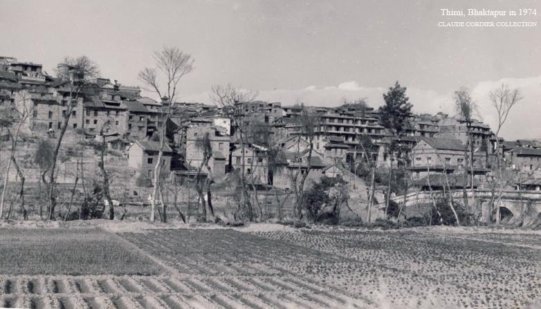
Barahaisthan, Bhaktapur in 1974
#
Bhairabnath temple
#
Bhaktapur festival 1997
#
bharbacho gate
#
Bhupatindra Malla
#
biska jatra/bisket jatra
#
Bisket Jatra 1988
#
Changunarayan Temple
#
Chariot (Rath)
#
Childhood of Bhaktapur
#
city
#
Culture
#
Dattatreya Square
#
Earthquake
#
events
#
Farmer
#
festival
#
gahiti
#
gai jatra (Sa: Paru)
#
gates of Bhaktapur
#
Golmadhi
#
hanumantey river
#
Harvesting
#
himalayas
#
Images of Taumadhi Square
#
kumari
#
Lho Hiti
#
living goddess
#
lyosindyo
#
Lyosinkhel
#
Mask
#
mohani nakha
#
na: pukhu
#
Naag pokhari (Sundhara of Bhaktapur)
#
Nagarkot hillstation
#
Nawadurga
#
nawarat
#
nyatapola temple
#
old architectures
#
old Bhaktapur Durbar Square
#
old images of nyatapola temple
#
Old Thimi
#
painting
#
Peacock Window
#
People
#
political flag
#
Ponds in old Bhaktapur
#
Pottery Square (Taalakwoh)
#
Pottery square in Thimi
#
Rene Tielenburg
#
Sculpture
#
staircase
#
Stone Spout
#
Stupa
#
Suryabinayak
#
suryabinyak
#
Temples of Bhaktapur
#
Toles of old Bhaktapur
#
Tradition
#
Traditional lifestyle
Back to Old Photos